Lesson 5
Map A Voyage Using Latitude and Longitude
- Time Required: 40 minutes
- Curriculum Fits: History, Geography
Overview
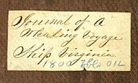
Ships' logbooks, kept by either the Captain or one of his mates, provide a rich resource for historians who hope to recreate the history of whaling. In this lesson, students explore sample logbook pages from the ship Virginia and discuss why these records were created. They then use logbook data to map the ship's route and determine the most profitable whaling areas in the mid 1800s.
Learning Objectives
- Students will explore sample pages from a whaling ship's log.
- Students will plot points on a world map to track the voyage of a whaling ship.
- Students will compare the route of whaling ships with whale breeding grounds.
Materials
- primary source: logbook pages from the Ship Virginia
- primary sources: artifacts from this website - Artifacts > About the Ship > Ship Accessories: "Ship Stamp", "Sperm Whale Stamp", and "Whale Stamp"
- primary source: 1831 Whale Chart; two sizes: display-sized 20" x 30" (42.4MB pdf file) or smaller 8.5" x 11"
- teacher resource: Background Info: 1851 Whale Chart
- student handout: Ship Virginia Longitude and Latitude Data, 1847-1851
- student handout: blank world map with longitude and latitude lines, find one on the internet
Preparation
Print out sample logbook pages from the Virginia's whaling voyage and a photograph of wooden stamps. For each student or pair of students, have a worksheet of excerpted logbook data and a world map (with longitudes and latitudes). Likewise, make multiple small copies or one large classroom copy of the Whale Chart from 1831.
Procedure
- Begin the lesson by reminding students that written records of whaling voyages help us to piece together the history of whaling. Ships' logbooks, kept by either the Captain or one of his mates, help us to recreate the past. Captain Henry Manter logged highlights of the Virginia's voyage. Tell students that they will be looking at a sample logbook page to determine what was recorded and why.
- Allow students to study sample logbook pages from the Virginia's voyage. Lead a discussion about what was noted in the log and why this information might have been recorded. At this time, it would be appropriate to share the photograph of several wooden stamps used to indicate ships and whales.
- Once students have finished discussing the usefulness of the log for whalers in the mid-1800s, tell them that they will be using excerpts from Virginia's logbook to recreate the route and whaling success of one voyage. Give students (or student partnerships) a worksheet of excerpted data from the Virginia logbook and ask them to plot the sequence of longitude and latitude positions on a world map. Have students connect the dots to show the route.
- After students have recreated Virginia's route, ask them to consider the dates and notations about captured whales. Where did the crew spend the bulk of their time away from home? Which oceans proved the most profitable for capturing sperm whales? Compare the answer to the latter question with information presented in the Whale Chart from 1831. Do the logbook and whale map provide consistent or conflicting information about where one finds a migratory source of oil?
Author
Mary Jane Aldrich-Moodie